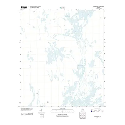
2011 Map of Dinner Pond
USGS Topo · Published 2011About this map
Middle Fork Suwannee River meanders through this portion of Charlton County, defining a landscape dominated by intricate wetlands and isolated high points. The terrain is characterized by a complex network of waterways and swampy depressions, where subtle elevations like Long Island and Camp Island provide the only significant dry land. This 2011 survey by the U.S. Geological Survey illustrates the primitive hydrological patterns of the region, including named basins such as Maul Hammock Lake and Big Water Lake. Small navigable channels like Bird Wing Run connect these larger bodies of water, showing the natural drainage system of the Georgia interior before modern development. The presence of Dog Island in the northern reaches further emphasizes the fragmented, island-studded nature of this swamp environment.
Find a feature on this map
8 named features on this map. Tap any name to fly to it.
Don’t see what you’re looking for? This feature index may not catch every label — zoom into the map to look around manually.
Map Details
Editions of this 2011 Dinner Pond Map
This is the sole edition of this map. No revisions or reprints were ever made.
Other maps of this area

1918 · Folkston
USGS Topo · 1:62,500

1953 · Waycross
USGS Topo · 1:250,000

1954 · Valdosta
USGS Topo · 1:250,000

1958 · Valdosta
USGS Topo · 1:250,000

1958 · Waycross
USGS Topo · 1:250,000

1959 · Valdosta
USGS Topo · 1:250,000

1965 · Double Lakes
USGS Topo · 1:24,000

1965 · Chase Prairie
USGS Topo · 1:24,000

1965 · Dinner Pond
USGS Topo · 1:24,000
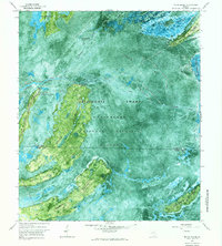
1966 · Billys Island
USGS Topo · 1:24,000