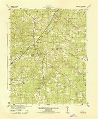
1944 Map of Dinwiddie
USGS Topo · Published 1944About this map
Dinwiddie serves as the focal point of this wartime topographical study, revealing the settlement patterns and infrastructure of south-central Virginia during the mid-1940s. The Seaboard railroad bisects the landscape, connecting the village center with outlying points like Jessup Store and Hamilton. Significant investment in local education and religious life is evident through the labeling of the Dinwiddie High School (Colored) and various rural congregations such as Olive Branch Church and St Thomas Church.
Find a feature on this map
25 named features on this map. Tap any name to fly to it.
Don’t see what you’re looking for? This feature index may not catch every label — zoom into the map to look around manually.
Map Details
Editions of this 1944 Dinwiddie Map
This is the sole edition of this map. No revisions or reprints were ever made.
Other maps of this area

1894 · Petersburg
USGS Topo · 1:62,500

1897 · Amelia
USGS Topo · 1:125,000

1919 · Jarratt
USGS Topo · 1:62,500

1919 · Mc Kenney
USGS Topo · 1:48,000

1921 · Mc Kenney
USGS Topo · 1:62,500

1943 · Mc Kenney
USGS Topo · 1:62,500

1943 · De Witt
USGS Topo · 1:24,000

1943 · Dinwiddie
USGS Topo · 1:24,000

1943 · Church Road
USGS Topo · 1:24,000

1943 · Sutherland
USGS Topo · 1:24,000