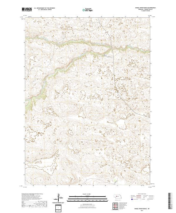
2021 Map of Dismal River Ranch
USGS Topo · Published 2021About this map
The N Fork Dismal River and S Fork Dismal River converge to form the Dismal River in this remote section of Hooker County. The landscape is defined by the winding hydrology of the Sandhills, where Spring Cr feeds into the northern fork amidst a complex network of dunes and interdunal valleys. Human presence is concentrated around the Dismal River Ranch, accessible via Riverside Dr. The map illustrates a ranching economy where property boundaries like t22n r33w and t21n r32w dictate the organization of the land. Further south, Muledeer Rd provides one of the few established transit routes through the undulating terrain, highlighting the isolation and specialized land use of this Nebraska interior.
Find a feature on this map
11 named features on this map. Tap any name to fly to it.
Don’t see what you’re looking for? This feature index may not catch every label — zoom into the map to look around manually.
Map Details
Editions of this 2021 Dismal River Ranch Map
This is the sole edition of this map. No revisions or reprints were ever made.
Other maps of this area

1947 · Dismal River Ranch
USGS Topo · 1:62,500

1949 · Dismal River Ranch
USGS Topo · 1:62,500

1949 · Wright Valley
USGS Topo · 1:62,500

1950 · Shimmins Lake
USGS Topo · 1:62,500

1951 · Tryon
USGS Topo · 1:62,500

1951 · Wright Valley
USGS Topo · 1:62,500

1954 · North Platte
USGS Topo · 1:250,000

1956 · North Platte
USGS Topo · 1:250,000

1957 · North Platte
USGS Topo · 1:250,000

1967 · North Platte
USGS Topo · 1:250,000