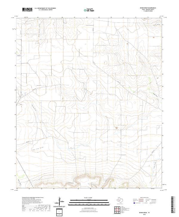
2022 Map of Divide Draw
USGS Topo · Published 2022About this map
Red House Draw and Divide Draw snake across this high plateau in Reagan County, defining a landscape shaped by intermittent watercourses rather than permanent rivers. The terrain is a network of drainage basins, where features like Big Jim Draw and Talley Draw channel seasonal runoff through the arid West Texas plains. This modern topographic study reveals a sparsely populated ranching territory where local movement relies on a handful of established thoroughfares like Ranch Rd 33 and Carr Ranch Rd. The absence of dense settlements highlights the vastness of the region's land holdings, with long-established property boundaries often following the natural contours of the draws. Researchers can trace the sophisticated road network that services the area's primary industries, including Rocky Rd and Becton Rd, which cut across the otherwise open expanse.
Find a feature on this map
14 named features on this map. Tap any name to fly to it.
Don’t see what you’re looking for? This feature index may not catch every label — zoom into the map to look around manually.
Map Details
Editions of this 2022 Divide Draw Map
This is the sole edition of this map. No revisions or reprints were ever made.
Other maps of this area

1920 · Big Lake
USGS Topo · 1:62,500

1922 · Big Lake
USGS Topo · 1:62,500

1928 · Rankin
USGS Topo · 1:125,000

1954 · San Angelo
USGS Topo · 1:250,000

1958 · San Angelo
USGS Topo · 1:250,000

1965 · San Angelo
USGS Topo · 1:250,000

1970 · South Mustang Draw SE
USGS Topo · 1:24,000

1970 · South Mustang Draw NE
USGS Topo · 1:24,000

1970 · Moore Hill
USGS Topo · 1:24,000

1970 · Gardener Draw
USGS Topo · 1:24,000