1994 Map of Divide
USGS Topo · Published 1998About this map
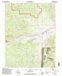
Divide serves as the central hub of this Teller County landscape, situated at a transition between protected lands and the high-altitude terrain. The map documents the extensive reach of the Pike National Forest and the Mueller State Park and Wildlife Area, while also marking the geological significance of the Florissant Fossil Beds National Monument. The area's extraction history is noted at the Black Cloud Mine, while modern utility infrastructure is represented by the Divide Aqueduct and a local substation. To the east, the elevation climbs toward Raspberry Mountain, overlooking a network of drainages including Redner Gulch and Drehette Gulch. Local genealogy is anchored by the Divide Cem, providing a fixed point for family history researchers tracing the inhabitants of these mountain settlements.
Find a feature on this map
27 named features on this map. Tap any name to fly to it.
Don’t see what you’re looking for? This feature index may not catch every label — zoom into the map to look around manually.
Map Details
Editions of this 1994 Divide Map
This is the sole edition of this map. No revisions or reprints were ever made.
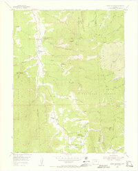
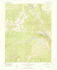
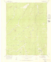
Other maps of this area

1893 · Platte Canyon
USGS Topo · 1:125,000

1894 · Pikes Peak
USGS Topo · 1:125,000

1901 · Pikes Peak
USGS Topo · 1:125,000

1901 · Pikes Peak
USGS Topo · 1:62,500

1951 · Pikes Peak
USGS Topo · 1:24,000

1951 · Cripple Creek North
USGS Topo · 1:24,000

1953 · Denver
USGS Topo · 1:250,000
1954 · Mount Deception
USGS Topo · 1:24,000
1954 · Woodland Park
USGS Topo · 1:24,000
1954 · Signal Butte
USGS Topo · 1:24,000