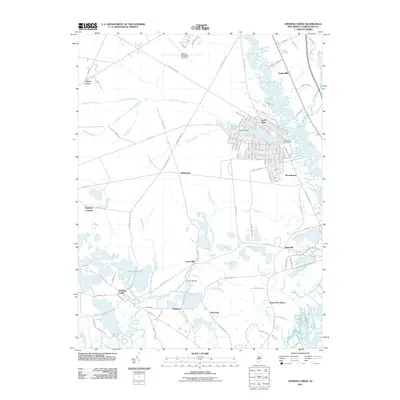
2011 Map of Dividing Creek
USGS Topo · Published 2011About this map
Dividing Creek and the surrounding marshlands of Cumberland County are defined by an intricate network of waterways flowing toward the Delaware Bay. This 2011 survey documents the dense residential development surrounding Laurel Lake, where the Beaver Dam and Laurel Lake Dam manage the local hydrology. The landscape transition from the dry pinelands near Centre Grove to the tidal reaches of the Maurice River is marked by a series of small, historic crossroads and hamlets such as Haleyville, Dragston, and New Italy.
Find a feature on this map
133 named features on this map. Tap any name to fly to it.
Don’t see what you’re looking for? This feature index may not catch every label — zoom into the map to look around manually.
Map Details
Editions of this 2011 Dividing Creek Map
This is the sole edition of this map. No revisions or reprints were ever made.
Other maps of this area

1888 · Dennisville
USGS Topo · 1:62,500

1890 · Tuckahoe
USGS Topo · 1:62,500

1890 · Maurice Cove
USGS Topo · 1:62,500

1890 · Bridgeton
USGS Topo · 1:62,500

1891 · Maurice Cove
USGS Topo · 1:62,500

1893 · Tuckahoe
USGS Topo · 1:62,500

1894 · Dennisville
USGS Topo · 1:62,500

1894 · Bridgeton
USGS Topo · 1:62,500

1899 · Vineland
USGS Topo · 1:125,000

1918 · Tuckahoe
USGS Topo · 1:62,500
Featured Places
- Millville, NJ
- Maurice River Township, NJ
- Commercial Township, NJ
- Lawrence Township, NJ
- Downe Township, NJ