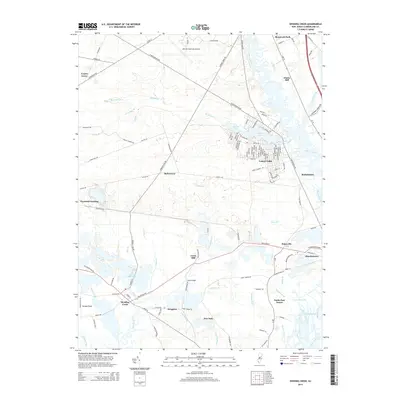
2014 Map of Dividing Creek
USGS Topo · Published 2014About this map
The Maurice River corridors and the low-lying wetlands of Cumberland County define this landscape, where old mill sites and small settlements are tied to the intricate hydrology of the region. Mauricetown and Haleyville anchor the eastern side of the survey, while the namesake community of Dividing Creek sits further west near Ladow Millpond. The presence of several historic milling locations, including Clarks Mill, Lores Mill, and the Iron Mine Br, points to a long history of water-powered industry and resource extraction in the coastal plain.
Find a feature on this map
127 named features on this map. Tap any name to fly to it.
Don’t see what you’re looking for? This feature index may not catch every label — zoom into the map to look around manually.
Map Details
Editions of this 2014 Dividing Creek Map
This is the sole edition of this map. No revisions or reprints were ever made.
Other maps of this area

1888 · Dennisville
USGS Topo · 1:62,500

1890 · Tuckahoe
USGS Topo · 1:62,500

1890 · Maurice Cove
USGS Topo · 1:62,500

1890 · Bridgeton
USGS Topo · 1:62,500

1891 · Maurice Cove
USGS Topo · 1:62,500

1893 · Tuckahoe
USGS Topo · 1:62,500

1894 · Dennisville
USGS Topo · 1:62,500

1894 · Bridgeton
USGS Topo · 1:62,500

1899 · Vineland
USGS Topo · 1:125,000

1918 · Tuckahoe
USGS Topo · 1:62,500
Featured Places
- Millville, NJ
- Maurice River Township, NJ
- Commercial Township, NJ
- Lawrence Township, NJ
- Downe Township, NJ