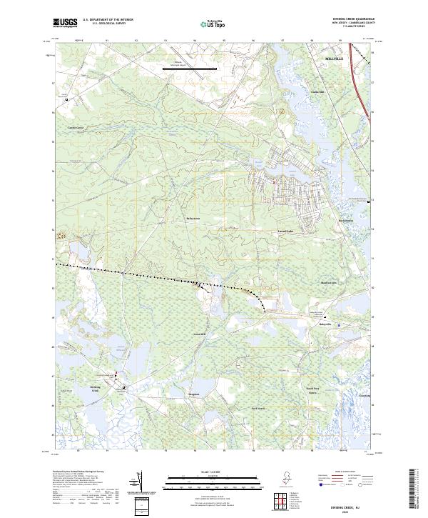
2023 Map of Dividing Creek
USGS Topo · Published 2023About this map
The Maurice River dominates the eastern landscape of this New Jersey survey, carving a path through the lowlands between Millville and the salt marshes near Leesburg. The region is defined by its extensive wetlands, including the broad Buckshutem Swamp and Cub Swamp, which are fed by numerous tributaries like Buckshutem Creek and Dividing Creek. Settlement patterns reflect the historic reliance on these waterways, with villages such as Mauricetown, Port Norris, and Haleyville positioned to access the river systems. Several historic burial grounds, such as the Dividing Creek Baptist Cem and Haleyville United Methodist Church Cem, provide anchor points for genealogical research. To the north, the Millville Municipal Airport introduces a modern utility to this otherwise traditional landscape of millponds and coastal plains.
Find a feature on this map
143 named features on this map. Tap any name to fly to it.
Don’t see what you’re looking for? This feature index may not catch every label — zoom into the map to look around manually.
Map Details
Editions of this 2023 Dividing Creek Map
This is the sole edition of this map. No revisions or reprints were ever made.
Other maps of this area

1888 · Dennisville
USGS Topo · 1:62,500

1890 · Tuckahoe
USGS Topo · 1:62,500

1890 · Maurice Cove
USGS Topo · 1:62,500

1890 · Bridgeton
USGS Topo · 1:62,500

1891 · Maurice Cove
USGS Topo · 1:62,500

1893 · Tuckahoe
USGS Topo · 1:62,500

1894 · Dennisville
USGS Topo · 1:62,500

1894 · Bridgeton
USGS Topo · 1:62,500

1899 · Vineland
USGS Topo · 1:125,000

1918 · Tuckahoe
USGS Topo · 1:62,500
Featured Places
- Millville, NJ
- Maurice River Township, NJ
- Commercial Township, NJ
- Lawrence Township, NJ
- Downe Township, NJ