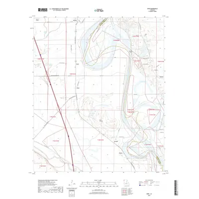
2018 Map of Dixie
USGS Topo · Published 2018About this map
Red River meanders define the boundary between Caddo Parish and Bossier Parish in this survey of the river valley north of Shreveport. The landscape is a complex network of active and former waterways, including the Moon Lake Bed, Bee Lake, and Gold Point Lake, which reflect the historical shifting of the river channel. Settlement patterns follow the higher ground and road networks, with established communities such as Belcher, Hayti, and Dixie situated west of the river along the Dixie Shreveport Rd corridor.
Find a feature on this map
62 named features on this map. Tap any name to fly to it.
Don’t see what you’re looking for? This feature index may not catch every label — zoom into the map to look around manually.
Map Details
Editions of this 2018 Dixie Map
This is the sole edition of this map. No revisions or reprints were ever made.
Other maps of this area

1932 · Bossier SW
USGS Topo · 1:31,680

1932 · Shreveport SE
USGS Topo · 1:31,680

1932 · Hosston SW
USGS Topo · 1:31,680

1932 · Hosston SE
USGS Topo · 1:31,680

1932 · Bossier NW
USGS Topo · 1:31,680

1932 · Shreveport NE
USGS Topo · 1:31,680

1948 · Mooringsport
USGS Topo · 1:62,500

1948 · Vivian
USGS Topo · 1:62,500

1948 · Bossier City
USGS Topo · 1:62,500

1950 · Plain Dealing SW
USGS Topo · 1:31,680