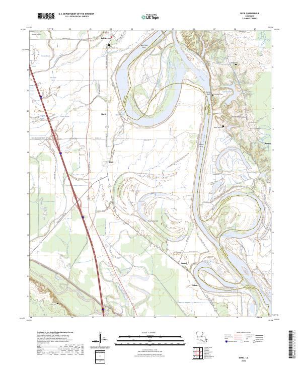
2024 Map of Dixie
USGS Topo · Published 2024About this map
The Red River carves a complex, winding path through the borderlands of Caddo and Bossier Parishes, leaving behind a landscape defined by oxbows and relic waterways. This modern survey captures the intricate drainage patterns of the bottomlands, where Sullivan Slough and the Moon Lake Bed signify the river's historical shifts. Small settlements like Belcher, Hayti, and Dixie are concentrated west of the river along Dixie Shreveport Rd, while the eastern side near Benton is marked by the distinct elevation of Hurricane Bluffs. The map documents numerous local burial grounds, including the Saint Paul Church Cem and the George Family Cem, providing essential data for genealogical research in this rural corridor. Navigation history is preserved through the locations of the Brier Field Ferry and Sentell Ferry, which once linked these riverfront communities.
Find a feature on this map
63 named features on this map. Tap any name to fly to it.
Don’t see what you’re looking for? This feature index may not catch every label — zoom into the map to look around manually.
Map Details
Editions of this 2024 Dixie Map
This is the sole edition of this map. No revisions or reprints were ever made.
Other maps of this area

1932 · Bossier SW
USGS Topo · 1:31,680

1932 · Shreveport SE
USGS Topo · 1:31,680

1932 · Hosston SW
USGS Topo · 1:31,680

1932 · Hosston SE
USGS Topo · 1:31,680

1932 · Bossier NW
USGS Topo · 1:31,680

1932 · Shreveport NE
USGS Topo · 1:31,680

1948 · Mooringsport
USGS Topo · 1:62,500

1948 · Vivian
USGS Topo · 1:62,500

1948 · Bossier City
USGS Topo · 1:62,500

1950 · Plain Dealing SW
USGS Topo · 1:31,680