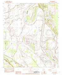
1982 Map of Dixie
USGS Topo · Published 1982About this map
The Red River dominates this landscape, winding through the alluvial plains of Caddo and Bossier Parishes. The river's historical shifts have left a complex network of oxbows and sloughs, including Moon Lake, Willow Lake, and Bee Lake, which trace the former path of the channel. The agrarian character of the region is centered on the Sentell Plantation and the namesake community of Dixie, reflecting a settlement pattern deeply tied to the fertile bottomlands and the river’s hydrological influence.
Find a feature on this map
28 named features on this map. Tap any name to fly to it.
Don’t see what you’re looking for? This feature index may not catch every label — zoom into the map to look around manually.
Map Details
Editions of this 1982 Dixie Map
This is the sole edition of this map. No revisions or reprints were ever made.
Other maps of this area

1932 · Bossier SW
USGS Topo · 1:31,680

1932 · Shreveport SE
USGS Topo · 1:31,680

1932 · Hosston SW
USGS Topo · 1:31,680

1932 · Hosston SE
USGS Topo · 1:31,680

1932 · Bossier NW
USGS Topo · 1:31,680

1932 · Shreveport NE
USGS Topo · 1:31,680

1948 · Mooringsport
USGS Topo · 1:62,500

1948 · Vivian
USGS Topo · 1:62,500

1948 · Bossier City
USGS Topo · 1:62,500

1950 · Plain Dealing SW
USGS Topo · 1:31,680