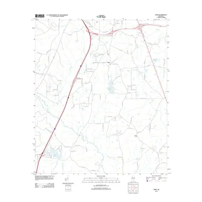
2012 Map of Dixie
USGS Topo · Published 2012About this map
Dixie serves as the focal point of this South Mississippi landscape, where rural road networks and creek drainages define the community's structure. The area is marked by a high concentration of family-named roads and burial sites, including Clark Cem, Dixie Cem, and Mineral Springs Cem, which provide essential touchpoints for local genealogical research. Water features heavily in the local geography, with Black Tom Cr and Tan Trough Cr winding through the terrain toward Black Creek. The presence of several private or recreational water bodies like Sumrall Lake, Elks Lake, and Beaver Lake suggests a shift toward residential and leisure land use in the early 21st century. The map detail highlights the fine-grained road system, from the arterial Old US Hwy 98 E to localized paths like Dixie Church Rd and Tatum Camp Rd, reflecting a landscape that balances traditional rural homesteads with modern infrastructure developments.
Find a feature on this map
110 named features on this map. Tap any name to fly to it.
Don’t see what you’re looking for? This feature index may not catch every label — zoom into the map to look around manually.
Map Details
Editions of this 2012 Dixie Map
This is the sole edition of this map. No revisions or reprints were ever made.
Other maps of this area

1947 · New Augusta
USGS Topo · 1:62,500

1949 · New Augusta
USGS Topo · 1:62,500

1953 · Hattiesburg
USGS Topo · 1:250,000

1958 · Hattiesburg
USGS Topo · 1:250,000

1963 · Rock Hill
USGS Topo · 1:24,000

1964 · Carterville
USGS Topo · 1:24,000

1964 · Purvis
USGS Topo · 1:24,000

1964 · Hattiesburg
USGS Topo · 1:24,000

1964 · Lumberton
USGS Topo · 1:24,000

1965 · Hattiesburg SW
USGS Topo · 1:24,000