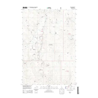
2013 Map of Dixie
USGS Topo · Published 2013About this map
Dixie and the neighboring settlement of Midasville occupy a high-elevation plateau within the Nez Perce National Forest. This 2013 survey illustrates a landscape defined by historic mining and timber interests, evidenced by features like the Dixie Woodyard and numerous prospect-oriented labels such as Hundred Dollar Gulch and Nugget Gulch. The terrain is shaped by a dense network of drainages, including Crooked Creek and Rhett Creek, which carve through the high country around Dixie Summit.
Find a feature on this map
50 named features on this map. Tap any name to fly to it.
Don’t see what you’re looking for? This feature index may not catch every label — zoom into the map to look around manually.
Map Details
Editions of this 2013 Dixie Map
This is the sole edition of this map. No revisions or reprints were ever made.
Other maps of this area

1931 · Buffalo Hump
USGS Topo · 1:125,000

1934 · Buffalo Hump
USGS Topo · 1:125,000

1956 · Warren
USGS Topo · 1:62,500

1956 · Elk City
USGS Topo · 1:250,000

1960 · Elk City
USGS Topo · 1:250,000

1977 · Silver Spur Ridge
USGS Topo · 1:24,000

1978 · Moose Butte
USGS Topo · 1:24,000

1978 · Trapper Creek
USGS Topo · 1:24,000
1979 · Orogrande
USGS Topo · 1:24,000

1979 · Dixie
USGS Topo · 1:24,000