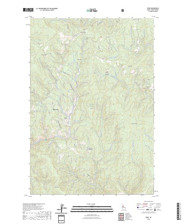
2024 Map of Dixie
USGS Topo · Published 2024About this map
Dixie and the neighboring settlement of Midasville occupy a clearing in the high country of the Nez Perce National Forest. This remote pocket of central Idaho is defined by a dense network of watercourses and mining-inflected landmarks, including the curiously named Hundred Dollar Gulch, Nugget Gulch, and Dixie Gulch. The landscape is a high-altitude drainage system for the South Fork Red River and Crooked Creek, which carves through the center of the quadrangle near North Star Meadows. To the south and east, the terrain transitions into the protected expanse of the Frank Church-River of No Return Wilderness. The map reveals the isolation of these communities, which are connected by forest development roads and served by the high-elevation D Bar C Airport situated just south of the main settlement.
Find a feature on this map
51 named features on this map. Tap any name to fly to it.
Don’t see what you’re looking for? This feature index may not catch every label — zoom into the map to look around manually.
Map Details
Editions of this 2024 Dixie Map
This is the sole edition of this map. No revisions or reprints were ever made.
Other maps of this area

1931 · Buffalo Hump
USGS Topo · 1:125,000

1934 · Buffalo Hump
USGS Topo · 1:125,000

1956 · Warren
USGS Topo · 1:62,500

1956 · Elk City
USGS Topo · 1:250,000

1960 · Elk City
USGS Topo · 1:250,000

1977 · Silver Spur Ridge
USGS Topo · 1:24,000

1978 · Moose Butte
USGS Topo · 1:24,000

1978 · Trapper Creek
USGS Topo · 1:24,000
1979 · Orogrande
USGS Topo · 1:24,000

1979 · Dixie
USGS Topo · 1:24,000