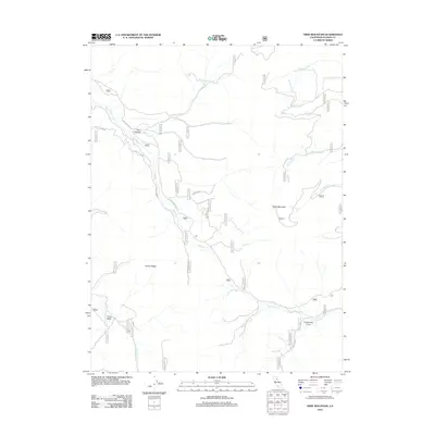
2012 Map of Dixie Mountain
USGS Topo · Published 2012About this map
Dixie Mountain stands as a central topographic anchor in this high-elevation region of Plumas County. The landscape is defined by the drainage systems of Dixie Cr and Frenchman Cr, which carve through the terrain between Horton Ridge and the Ross Canyon area. This 2012 survey illustrates a remote network of forest and valley access routes, including Dixie Valley Rd and Pioneer Way, which navigate the various forks and necks of the mountainside. Water features such as Twitchell Reservoir and Frenchman Cove indicate the management of mountain runoff for the region. The map highlights the intersection of natural hydrology and man-made infrastructure, such as Cove Rd, providing a clear record of the watershed's configuration in the early 21st century.
Find a feature on this map
19 named features on this map. Tap any name to fly to it.
Don’t see what you’re looking for? This feature index may not catch every label — zoom into the map to look around manually.
Map Details
Editions of this 2012 Dixie Mountain Map
This is the sole edition of this map. No revisions or reprints were ever made.
Other maps of this area

1886 · Honey Lake
USGS Topo · 1:250,000

1890 · Sierraville
USGS Topo · 1:125,000

1891 · Honey Lake
USGS Topo · 1:250,000

1892 · Sierraville
USGS Topo · 1:125,000

1893 · Honey Lake
USGS Topo · 1:250,000

1894 · Sierraville
USGS Topo · 1:125,000

1950 · Chilcoot
USGS Topo · 1:62,500

1950 · Portola
USGS Topo · 1:62,500

1950 · Milford
USGS Topo · 1:62,500

1954 · Doyle
USGS Topo · 1:62,500