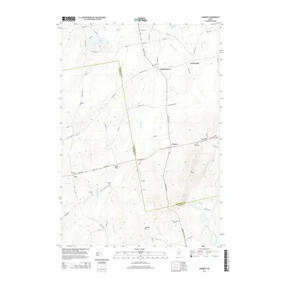
2014 Map of Dixmont
USGS Topo · Published 2014About this map
Martin Stream flows through the center of this rural Maine landscape, connecting the clustered settlements and family-named cemeteries that define the border between Penobscot and Waldo counties. The village of Dixmont serves as a central hub, flanked by outlying hamlets like North Dixmont, Rollins Mills, and East Troy. This 2014 survey documents a deeply rooted agricultural and local history, where the terrain is dominated by high points like Mt Harris and Common Hill.
Find a feature on this map
68 named features on this map. Tap any name to fly to it.
Don’t see what you’re looking for? This feature index may not catch every label — zoom into the map to look around manually.
Map Details
Editions of this 2014 Dixmont Map
This is the sole edition of this map. No revisions or reprints were ever made.
Other maps of this area

1926 · Burnham
USGS Topo · 1:62,500

1930 · Pittsfield
USGS Topo · 1:48,000

1931 · Stetson
USGS Topo · 1:48,000

1932 · Brooks
USGS Topo · 1:62,500

1932 · Pittsfield
USGS Topo · 1:62,500

1933 · Pittsfield
USGS Topo · 1:62,500

1935 · Stetson
USGS Topo · 1:62,500

1948 · Bangor
USGS Topo · 1:250,000

1955 · Pittsfield
USGS Topo · 1:62,500

1955 · Brooks
USGS Topo · 1:62,500