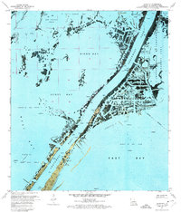
1971 Map of Dixon Bay
USGS Topo · Published 1974About this map
Southwest Pass serves as the dominant navigational artery in this 1971 orthophotomap of the Mississippi River Delta. The landscape is a complex mosaic of marsh and open water, where natural features like Bob Taylors Pond and Joseph Bayou reveal the intricate hydrology of Plaquemines Parish. Industrial activity is pervasive throughout the area, evidenced by numerous oil wells, platforms, and sludge pits scattered across Zinzin Bay and Scott Bay. To the east, the Pass A Loutre State Waterfowl Management Area covers a significant portion of the delta, protecting the tidal wetlands. This survey provides a precise visual of the shoreline before decades of coastal erosion further altered the deltaic landforms, capturing the specific locations of remote infrastructure like a Helicopter Pad and Radio Tower that supported the offshore energy industry.
Find a feature on this map
28 named features on this map. Tap any name to fly to it.
Don’t see what you’re looking for? This feature index may not catch every label — zoom into the map to look around manually.
Map Details
Editions of this 1971 Dixon Bay Map
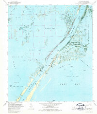
2 editions found
Other maps of this area

1893 · East Delta
USGS Topo · 1:62,500

1893 · West Delta
USGS Topo · 1:62,500

1935 · South Pass
USGS Topo · 1:31,680

1946 · Pass Du Bois
USGS Topo · 1:31,680

1946 · Mudpan Bayou
USGS Topo · 1:31,680

1946 · Pass Tante Phine
USGS Topo · 1:31,680

1947 · Pass A Loutre West
USGS Topo · 1:31,680

1947 · Southwest Pass
USGS Topo · 1:31,680

1949 · Cubits Gap
USGS Topo · 1:31,680
1949 · Burrwood
USGS Topo · 1:31,680