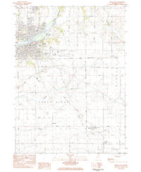
1983 Map of Dixon East
USGS Topo · Published 1984About this map
The Rock River winds through the northern portion of this Lee County landscape, anchoring the city of Dixon and its varied mid-century infrastructure. This 1980s-era record details a community defined by its civic institutions and transportation hubs, from the sprawling grounds of the State Developmental Center and Page Park to the Dixon Municipal Airport. The map documents the city's expansion south and east toward the Illinois Tollway, while preserving the locations of numerous historic burial grounds such as Oakwood Cemetery and Chapel Hill Cem.
Find a feature on this map
76 named features on this map. Tap any name to fly to it.
Don’t see what you’re looking for? This feature index may not catch every label — zoom into the map to look around manually.
Map Details
Editions of this 1983 Dixon East Map
This is the sole edition of this map. No revisions or reprints were ever made.
Other maps of this area

1918 · Dixon
USGS Topo · 1:62,500

1930 · Woodsung
USGS Topo · 1:48,000

1946 · Sterling
USGS Topo · 1:62,500

1948 · Sterling
USGS Topo · 1:62,500

1949 · Walnut
USGS Topo · 1:62,500

1950 · Dixon
USGS Topo · 1:62,500

1951 · Amboy
USGS Topo · 1:62,500

1958 · Aurora
USGS Topo · 1:250,000

1961 · Aurora
USGS Topo · 1:250,000

1982 · Harmon
USGS Topo · 1:24,000