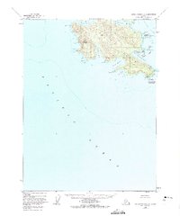
1948 Map of Dixon Entrance C-3
USGS Topo · Published 1975About this map
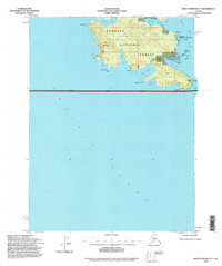
Dall Island dominates this 1948 survey, showcasing the southern reaches of the Alexander Archipelago at the international boundary between the United States and Canada. The landscape is defined by the high peak of Stripe Mountain and a shoreline deeply incised by protected waters such as Security Cove, Wolk Harbor, and Mc Leod Bay. Of particular interest to historical researchers is the Kaigani (Site) near Cape Muzon, marking a significant location along the Kaigani Strait. The map captures the maritime orientation of this remote area, from the Datzkoo Islands to the coastal light at the tip of the island. The topography reflects a time before extensive modern development, focusing on the natural harbors and named points like Pt Cornwallis and Aurora Pt that served as vital landmarks for Pacific coastal navigation.
Find a feature on this map
27 named features on this map. Tap any name to fly to it.
Don’t see what you’re looking for? This feature index may not catch every label — zoom into the map to look around manually.
Map Details
Editions of this 1948 Dixon Entrance C-3 Map
3 editions found
Other maps of this area

1948 · Dixon Entrance D-2
USGS Topo · 1:63,360
1948 · Dixon Entrance C-3
USGS Topo · 1:63,360

1948 · Dixon Entrance D-4
USGS Topo · 1:63,360

1948 · Dixon Entrance D-3
USGS Topo · 1:63,360

1951 · Dixon Entrance
USGS Topo · 1:250,000

1951 · Dixon Entrance D-3
USGS Topo · 1:63,360

1951 · Dixon Entrance D-2
USGS Topo · 1:63,360
1951 · Dixon Entrance D-4
USGS Topo · 1:63,360

1959 · Dixon Entrance
USGS Topo · 1:250,000
1994 · Dixon Entrance C-3
USGS Topo · 1:63,360