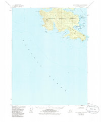
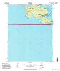
1948 Map of Dixon Entrance C-3
USGS Topo · Published 1986About this map
Dall Island dominates the southeastern maritime frontier of the Tongass National Forest in this mid-century survey. The landscape is defined by its deep coastal indentations, including Security Cove and the narrow waters of Liscome Bay. Settlement is sparse and focused on coastal points, with locations such as Security Pt, Liscome Pt, and Wolk Pt serving as landmarks for navigation along the jagged shoreline. On the southern tip of the island, the Kaigani (Site) indicates a historical point of occupation near Kaigani Strait. The interior is characterized by significant elevations like Stripe Mountain, while the surrounding waters of the Pacific Ocean and Mc Leod Bay highlight the region's total reliance on maritime access and seasonal coastal resources during this era.
Find a feature on this map
25 named features on this map. Tap any name to fly to it.
Don’t see what you’re looking for? This feature index may not catch every label — zoom into the map to look around manually.
Map Details
Editions of this 1948 Dixon Entrance C-3 Map
3 editions found
Other maps of this area

1948 · Dixon Entrance D-2
USGS Topo · 1:63,360
1948 · Dixon Entrance C-3
USGS Topo · 1:63,360

1948 · Dixon Entrance D-4
USGS Topo · 1:63,360

1948 · Dixon Entrance D-3
USGS Topo · 1:63,360

1951 · Dixon Entrance
USGS Topo · 1:250,000

1951 · Dixon Entrance D-3
USGS Topo · 1:63,360

1951 · Dixon Entrance D-2
USGS Topo · 1:63,360
1951 · Dixon Entrance D-4
USGS Topo · 1:63,360

1959 · Dixon Entrance
USGS Topo · 1:250,000
1994 · Dixon Entrance C-3
USGS Topo · 1:63,360