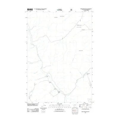
2011 Map of Dixon Mountain
USGS Topo · Published 2011About this map
Dixon Mountain stands as a central landmark within this portion of the Tendoy Mountains in Beaverhead County. The landscape is defined by a complex drainage network where Muddy Creek and its tributaries, such as McNinch Creek and Johnson Creek, carve through the western slopes. To the east, the terrain is shaped by the significant flow of Big Sheep Creek, which is fed by Hidden Pasture Creek. This 2011 survey captures a region characterized by specialized resource extraction and water management, evidenced by the Little Water Canyon Mine and several named water sources like Harkness Spring and Rock Spring. The geography is further articulated by numerous named canyons and hollows, including Trail Hollow, Rock Canyon, and Williamson Wood Canyon, which indicate a long history of local naming conventions for the various draws and geological depressions used by ranchers and hunters in this part of Montana.
Find a feature on this map
19 named features on this map. Tap any name to fly to it.
Don’t see what you’re looking for? This feature index may not catch every label — zoom into the map to look around manually.
Map Details
Editions of this 2011 Dixon Mountain Map
This is the sole edition of this map. No revisions or reprints were ever made.
Other maps of this area

1955 · Dubois
USGS Topo · 1:250,000

1958 · Dubois
USGS Topo · 1:250,000

1965 · Kidd
USGS Topo · 1:24,000

1965 · Caboose Canyon
USGS Topo · 1:24,000

1965 · Gallagher Gulch
USGS Topo · 1:24,000

1965 · Briggs Ranch
USGS Topo · 1:24,000

1965 · Graphite Mountain
USGS Topo · 1:24,000

1965 · Deer Canyon
USGS Topo · 1:24,000

1965 · Dixon Mountain
USGS Topo · 1:24,000

1965 · Dell
USGS Topo · 1:24,000