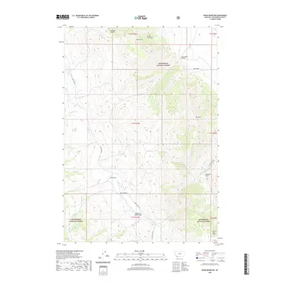
2020 Map of Dixon Mountain
USGS Topo · Published 2020About this map
Timber Butte and the Tendoy Mountains dominate this high-altitude landscape within the Beaverhead National Forest. This 2020 survey documents a complex network of canyons and gulches, including Little Water Canyon and Dry Canyon in the northeast, while Dixon Mtn stands as a prominent landmark in the east. The drainage pattern is defined by Muddy Creek and Big Sheep Creek, which are traced by the primary access routes Muddy Creek Rd and Big Sheep Creek Rd. Remote water sources such as Harkness Spring and Rock Spring are critical points in this arid, high-country environment. The map provides a detailed topographic view of the transitioning elevations from White Pine Ridge to the deep recesses of Deadwood Gulch and Rock Canyon.
Find a feature on this map
28 named features on this map. Tap any name to fly to it.
Don’t see what you’re looking for? This feature index may not catch every label — zoom into the map to look around manually.
Map Details
Editions of this 2020 Dixon Mountain Map
This is the sole edition of this map. No revisions or reprints were ever made.
Other maps of this area

1955 · Dubois
USGS Topo · 1:250,000

1958 · Dubois
USGS Topo · 1:250,000

1965 · Kidd
USGS Topo · 1:24,000

1965 · Caboose Canyon
USGS Topo · 1:24,000

1965 · Gallagher Gulch
USGS Topo · 1:24,000

1965 · Briggs Ranch
USGS Topo · 1:24,000

1965 · Graphite Mountain
USGS Topo · 1:24,000

1965 · Deer Canyon
USGS Topo · 1:24,000

1965 · Dixon Mountain
USGS Topo · 1:24,000

1965 · Dell
USGS Topo · 1:24,000