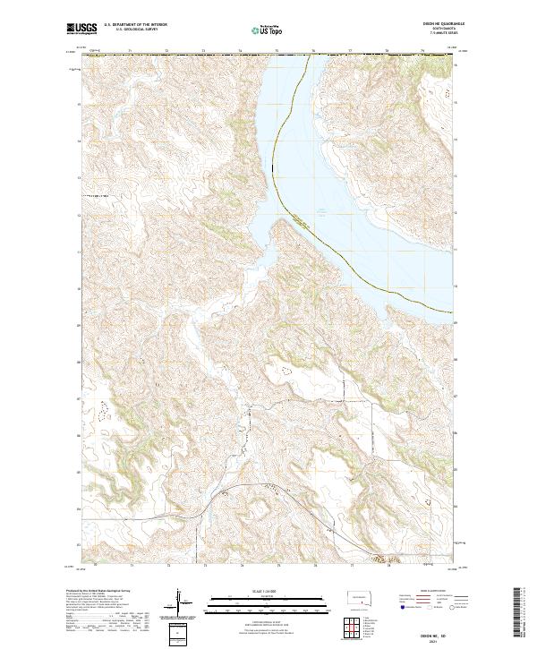
2021 Map of Dixon NE
USGS Topo · Published 2021About this map
Lake Francis Case dominates the eastern boundary of this South Dakota landscape, where the Missouri River forms a natural divide between Gregory Co and Charles Mix Co. The terrain is defined by a dense network of drainages carving through the plains, including Rush Cr, Fivemile Cr, and the winding path of Landing Cr. These intermittent streams and coulees illustrate the erosion patterns characteristic of the region's breaks, leading down toward the massive reservoir. In the upland areas, Berry Spring provides a rare named water source amidst the complex topography. While the map is predominantly open country, the presence of the Turney Township Hwy and section-line roads indicates the persistent grid of the Public Land Survey System that governs the rural agricultural and ranching economy of this Missouri River borderland.
Find a feature on this map
15 named features on this map. Tap any name to fly to it.
Don’t see what you’re looking for? This feature index may not catch every label — zoom into the map to look around manually.
Map Details
Editions of this 2021 Dixon NE Map
This is the sole edition of this map. No revisions or reprints were ever made.
Other maps of this area

1940 · Iona
USGS Topo · 1:62,500

1944 · Iona
USGS Topo · 1:62,500

1955 · Mitchell
USGS Topo · 1:250,000

1959 · Mitchell
USGS Topo · 1:250,000

1971 · Lucas NW
USGS Topo · 1:24,000

1971 · Dixon SW
USGS Topo · 1:24,000

1971 · Lucas
USGS Topo · 1:24,000

1971 · Dixon
USGS Topo · 1:24,000

1971 · Dixon SE
USGS Topo · 1:24,000

1971 · Dixon NE
USGS Topo · 1:24,000
Featured Places
- America Township, SD
- Bull Creek Segment, SD
- La Roche Township, SD
- Milk's Camp Segment, SD
- Charles Mix County, SD