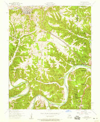
1954 Map of Dixon
USGS Topo · Published 1959About this map
The town of Dixon serves as the focal point for this mid-century survey of the Ozark plateau, where the San Francisco And St Louis Railroad cuts through the high ground before the terrain drops into the winding river valleys below. To the south and east, the landscape becomes increasingly intricate as the Gasconade River and Big Piney River meander through deep hollows. This area is heavily wooded, marked by the boundaries of the Mark Twain National Forest and dotted with small rural communities like Powellville and Clementine.
Find a feature on this map
50 named features on this map. Tap any name to fly to it.
Don’t see what you’re looking for? This feature index may not catch every label — zoom into the map to look around manually.
Map Details
Editions of this 1954 Dixon Map
4 editions found
Other maps of this area

1888 · Tuscumbia
USGS Topo · 1:125,000

1894 · Tuscumbia
USGS Topo · 1:125,000

1912 · Rolla
USGS Topo · 1:62,500

1936 · Waynesville
USGS Topo · 1:48,000

1937 · Vienna
USGS Topo · 1:62,500

1938 · Vienna
USGS Topo · 1:48,000

1942 · Waynesville
USGS Topo · 1:62,500

1944 · Waynesville
USGS Topo · 1:62,500

1947 · Jefferson City
USGS Topo · 1:250,000

1948 · Tavern
USGS Topo · 1:62,500