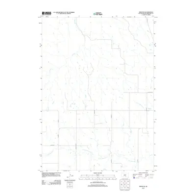
2012 Map of Dixon SE
USGS Topo · Published 2012About this map
S Fork Whetstone Cr and N Fork Whetstone Cr define the drainage patterns of this rural Gregory County landscape. The area is characterized by a grid of township and county roads that intersect the prairie, including Lucas Twp Hwy and Huston Twp Hwy. These routes follow section lines, providing access to the various farmsteads and agricultural plots that have shaped this region of South Dakota.
Find a feature on this map
13 named features on this map. Tap any name to fly to it.
Don’t see what you’re looking for? This feature index may not catch every label — zoom into the map to look around manually.
Map Details
Editions of this 2012 Dixon SE Map
This is the sole edition of this map. No revisions or reprints were ever made.
Other maps of this area

1955 · Mitchell
USGS Topo · 1:250,000

1959 · Mitchell
USGS Topo · 1:250,000

1964 · Herrick NW
USGS Topo · 1:24,000

1964 · Gregory
USGS Topo · 1:24,000
1964 · Burke
USGS Topo · 1:24,000

1971 · Lucas NW
USGS Topo · 1:24,000

1971 · Dixon SW
USGS Topo · 1:24,000

1971 · Lucas
USGS Topo · 1:24,000

1971 · Dixon
USGS Topo · 1:24,000

1971 · Dixon SE
USGS Topo · 1:24,000