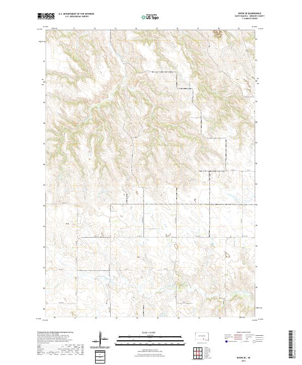
2021 Map of Dixon SE
USGS Topo · Published 2021About this map
Landing Cr carves a deep, winding drainage system through the northern plateau of this Gregory County landscape, reflecting the classic dissected terrain of the Missouri River hills. The map depicts a late-modern era of organized rural transit, where the cardinal-direction grid of section roads is interrupted by the local topography and historical travel routes like the Huston Township Hwy. To the south and east, the headwaters of the S Fork Whetstone Cr and N Fork Whetstone Cr begin their descent, creating a complex series of draws and ridges. These geographical features dictated the placement of early infrastructure, seen in the winding path of Lucas Rd as it skirts the southern drainage. The survey provides a clear view of the agricultural land divisions and the sparse, wide-open character of the South Dakota prairie before these creeks merge into larger systems.
Find a feature on this map
31 named features on this map. Tap any name to fly to it.
Don’t see what you’re looking for? This feature index may not catch every label — zoom into the map to look around manually.
Map Details
Editions of this 2021 Dixon SE Map
This is the sole edition of this map. No revisions or reprints were ever made.
Other maps of this area

1955 · Mitchell
USGS Topo · 1:250,000

1959 · Mitchell
USGS Topo · 1:250,000

1964 · Herrick NW
USGS Topo · 1:24,000

1964 · Gregory
USGS Topo · 1:24,000
1964 · Burke
USGS Topo · 1:24,000

1971 · Lucas NW
USGS Topo · 1:24,000

1971 · Dixon SW
USGS Topo · 1:24,000

1971 · Lucas
USGS Topo · 1:24,000

1971 · Dixon
USGS Topo · 1:24,000

1971 · Dixon SE
USGS Topo · 1:24,000