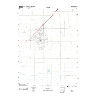
2012 Map of Dixon
USGS Topo · Published 2012About this map
Dixon sits at the heart of this Solano County landscape, where an organized grid of residential streets like Priddy Dr and Dorset Ln meets the sprawling agricultural acreage of the Sacramento Valley. The transition from town to country is marked by several large named operations, including Eatwell Farm, Redeille Farms, and Freese Farms. These holdings reflect the region's enduring identity as a productive farming hub, even as residential developments expand toward the north and west.
Find a feature on this map
86 named features on this map. Tap any name to fly to it.
Don’t see what you’re looking for? This feature index may not catch every label — zoom into the map to look around manually.
Map Details
Editions of this 2012 Dixon Map
This is the sole edition of this map. No revisions or reprints were ever made.
Other maps of this area

1907 · Woodland
USGS Topo · 1:62,500

1907 · Davisville
USGS Topo · 1:62,500

1908 · Vacaville
USGS Topo · 1:62,500

1908 · Courtland
USGS Topo · 1:62,500

1915 · Swingle
USGS Topo · 1:31,680

1915 · Merritt
USGS Topo · 1:31,680

1916 · Dixon
USGS Topo · 1:31,680

1916 · Cache Slough
USGS Topo · 1:31,680

1916 · Winters
USGS Topo · 1:31,680

1916 · Maine Prairie
USGS Topo · 1:31,680