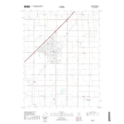
2018 Map of Dixon
USGS Topo · Published 2018About this map
Dixon sits as the central hub of this agricultural landscape within the Sacramento Valley, where a grid of rural roads and irrigation channels defines the terrain. The map highlights the town's expansion with modern residential developments like Dixon Ridge alongside the historic Silveyville Cem, a vital link to the area's pioneer past. This late 2010s survey captures the balance between growing suburban footprints and the enduring orchard and field culture of Solano County. To the south, the Maine Prairie Airport serves as a distinct landmark in the open flats of the Central Valley. Drainage and local hydrology are dominated by Dickson Creek, Sweany Creek, and Gibson Canyon Creek, which thread through the large parcels of land characterized by names like Sparks Ranch Road and Milk Farm Road. Smaller rail-side or crossroads settlements including Sucro and Batavia remain identifiable points on the transit network.
Find a feature on this map
85 named features on this map. Tap any name to fly to it.
Don’t see what you’re looking for? This feature index may not catch every label — zoom into the map to look around manually.
Map Details
Editions of this 2018 Dixon Map
This is the sole edition of this map. No revisions or reprints were ever made.
Other maps of this area

1907 · Woodland
USGS Topo · 1:62,500

1907 · Davisville
USGS Topo · 1:62,500

1908 · Vacaville
USGS Topo · 1:62,500

1908 · Courtland
USGS Topo · 1:62,500

1915 · Swingle
USGS Topo · 1:31,680

1915 · Merritt
USGS Topo · 1:31,680

1916 · Dixon
USGS Topo · 1:31,680

1916 · Cache Slough
USGS Topo · 1:31,680

1916 · Winters
USGS Topo · 1:31,680

1916 · Maine Prairie
USGS Topo · 1:31,680