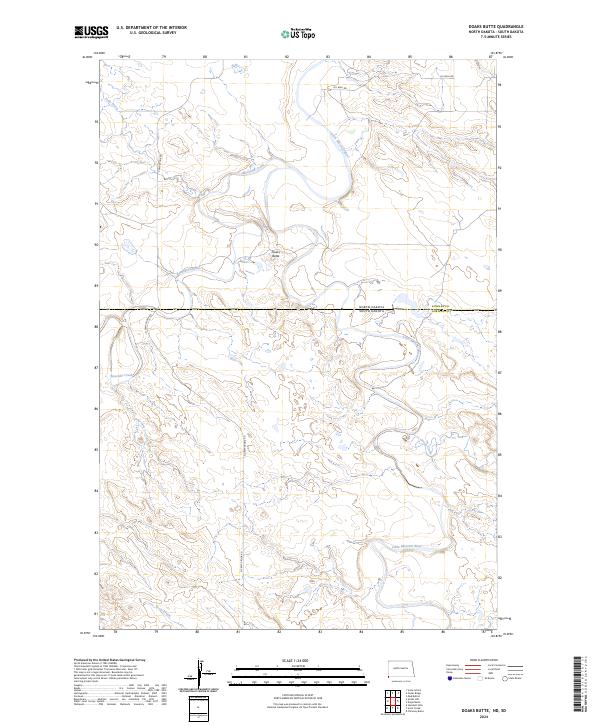
2024 Map of Doaks Butte
USGS Topo · Published 2024About this map
The Little Missouri River carves a serpentine path through this high-plains landscape where the borders of North Dakota and South Dakota meet. Centered on the prominence of Doaks Butte, the terrain is defined by a network of drainage systems including Boxelder Creek, Soda Creek, and Arnett Creek. This recent survey reveals a landscape where traditional ranching geography intersects with modern industrial activity, evidenced by the development of Oil Well Rd and Oil Field Rd north of the state line. The map provides a precise view of the rural infrastructure connecting Bowman County, North Dakota, with Harding County, South Dakota, along the corridor of Camp Crook Rd.
Find a feature on this map
18 named features on this map. Tap any name to fly to it.
Don’t see what you’re looking for? This feature index may not catch every label — zoom into the map to look around manually.
Map Details
Editions of this 2024 Doaks Butte Map
This is the sole edition of this map. No revisions or reprints were ever made.
Other maps of this area

1935 · Buffalo
USGS Topo · 1:125,000

1953 · Miles City
USGS Topo · 1:250,000

1953 · Dickinson
USGS Topo · 1:250,000

1954 · Lemmon
USGS Topo · 1:250,000

1954 · Ekalaka
USGS Topo · 1:250,000

1956 · Ekalaka
USGS Topo · 1:250,000

1957 · Dickinson
USGS Topo · 1:250,000

1957 · Lemmon
USGS Topo · 1:250,000

1957 · Miles City
USGS Topo · 1:250,000

1958 · Miles City
USGS Topo · 1:250,000