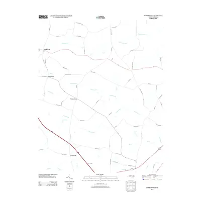
2013 Map of Dobbersville
USGS Topo · Published 2013About this map
Thoroughfare Swamp and Goshen Swamp dominate the low-lying drainage patterns of this eastern North Carolina landscape, where small agricultural settlements are connected by a network of rural roads. Communities such as Dobbersville, Suttontown, and Giddensville serve as focal points for the surrounding farmsteads. The terrain is characterized by its hydrologic features, including the distinctive Bear Pocosin and several named branches such as Mill Br and Panther Br that feed into the larger swamp systems.
Find a feature on this map
56 named features on this map. Tap any name to fly to it.
Don’t see what you’re looking for? This feature index may not catch every label — zoom into the map to look around manually.
Map Details
Editions of this 2013 Dobbersville Map
This is the sole edition of this map. No revisions or reprints were ever made.
Other maps of this area

1906 · Four Oaks
USGS Topo · 1:48,000

1908 · Four Oaks
USGS Topo · 1:62,500

1909 · Coharie
USGS Topo · 1:62,500

1953 · Raleigh
USGS Topo · 1:250,000

1954 · Raleigh
USGS Topo · 1:250,000

1974 · Grantham
USGS Topo · 1:24,000

1974 · Southwest Goldsboro
USGS Topo · 1:24,000

1975 · Faison
USGS Topo · 1:24,000
1977 · Warsaw North
USGS Topo · 1:24,000
1977 · Mount Olive
USGS Topo · 1:24,000