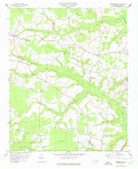
1978 Map of Dobbersville
USGS Topo · Published 1978About this map
Dobbersville serves as a primary settlement node in this eastern North Carolina landscape, where the tri-county borders of Sampson, Wayne, and Duplin meet. The geography is defined by a dense network of blackwater drainage systems, most notably Thoroughfare Swamp and Goshen Swamp, which interlace with the agricultural uplands. The distribution of numerous small country churches, such as Brownings Ch, Saints Delight Ch, and Smith Chapel, reflects the established social fabric of these rural communities in the late 1970s.
Find a feature on this map
28 named features on this map. Tap any name to fly to it.
Don’t see what you’re looking for? This feature index may not catch every label — zoom into the map to look around manually.
Map Details
Editions of this 1978 Dobbersville Map
This is the sole edition of this map. No revisions or reprints were ever made.
Other maps of this area

1906 · Four Oaks
USGS Topo · 1:48,000

1908 · Four Oaks
USGS Topo · 1:62,500

1909 · Coharie
USGS Topo · 1:62,500

1953 · Raleigh
USGS Topo · 1:250,000

1954 · Raleigh
USGS Topo · 1:250,000

1974 · Grantham
USGS Topo · 1:24,000

1974 · Southwest Goldsboro
USGS Topo · 1:24,000

1975 · Faison
USGS Topo · 1:24,000
1977 · Warsaw North
USGS Topo · 1:24,000
1977 · Mount Olive
USGS Topo · 1:24,000