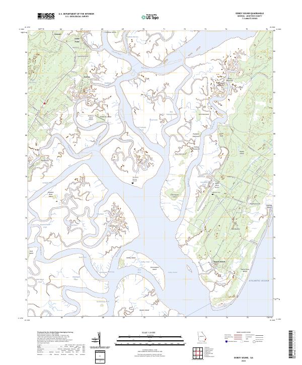
2024 Map of Doboy Sound
USGS Topo · Published 2024About this map
Sapelo Island and its surrounding marshlands anchor this coastal Georgia survey, revealing a landscape defined by complex tidal systems and long-standing local communities. The intricate geography of the Duplin River and Mud River carves through numerous hammocks and islands, including Hog Hammock and Creighton Island. Of particular interest to local historians are the Behavior Cem and the Old Sailors Burying Ground, which provide a tangible link to the island's maritime and cultural heritage.
Find a feature on this map
88 named features on this map. Tap any name to fly to it.
Don’t see what you’re looking for? This feature index may not catch every label — zoom into the map to look around manually.
Map Details
Editions of this 2024 Doboy Sound Map
This is the sole edition of this map. No revisions or reprints were ever made.
Other maps of this area

1920 · Sapelo River
USGS Topo · 1:62,500

1920 · Cabretta Island
USGS Topo · 1:62,500

1921 · Darien
USGS Topo · 1:62,500

1928 · St Catherines Island
USGS Topo · 1:62,500

1943 · St Catherines Island
USGS Topo · 1:62,500

1943 · Sapelo River
USGS Topo · 1:62,500

1944 · Cabretta Island
USGS Topo · 1:62,500

1945 · St. Catherine's Island
USGS Topo · 1:62,500

1945 · Sapelo River
USGS Topo · 1:62,500

1946 · Brunswick
USGS Topo · 1:250,000