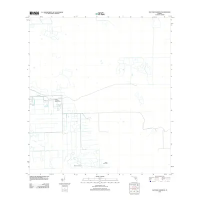
2012 Map of Doctors Hammock
USGS Topo · Published 2012About this map
Doctors Hammock and Dozier Hammock define this low-lying stretch of South Florida terrain, characterized by a complex network of canals and drainage ditches that illustrate modern water management in the region. The landscape is sparse, marked primarily by the sprawling infrastructure of the Hendry Correctional Institute Airport and the straightened passage of Co Rd 858 E cutting across the central portion of the quadrangle. This 2012 survey reveals the geometric precision of the area's development, where vast tracts are organized around extensive water control systems. The isolation of the hammocks amidst these engineered waterways highlights the specialized land use typical of the western Everglades periphery during the early twenty-first century.
Find a feature on this map
4 named features on this map. Tap any name to fly to it.
Don’t see what you’re looking for? This feature index may not catch every label — zoom into the map to look around manually.
Map Details
Editions of this 2012 Doctors Hammock Map
This is the sole edition of this map. No revisions or reprints were ever made.
Other maps of this area

1956 · West Palm Beach
USGS Topo · 1:250,000

1957 · West Palm Beach
USGS Topo · 1:250,000

1958 · West Palm Beach
USGS Topo · 1:250,000

1958 · Sunniland
USGS Topo · 1:24,000

1958 · Immokalee NE
USGS Topo · 1:24,000

1959 · Miles City
USGS Topo · 1:24,000

1974 · Immokalee 4 NW
USGS Topo · 1:24,000

1974 · Immokalee 1 SW
USGS Topo · 1:24,000

1974 · Immokalee 1 SE
USGS Topo · 1:24,000

1974 · Immokalee 1 NE
USGS Topo · 1:24,000