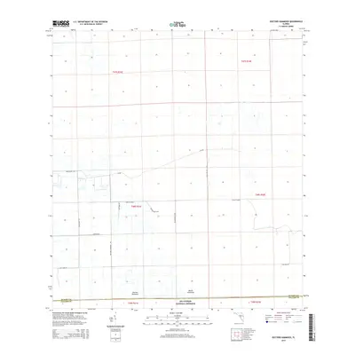
2015 Map of Doctors Hammock
USGS Topo · Published 2015About this map
Doctors Hammock and Dozier Hammock serve as the primary topographical landmarks in this transition zone between agricultural activity and the northern edge of the Big Cypress National Preserve. Situated on the boundary between Collier and Hendry counties, the landscape is defined by a grid of agricultural access roads and drainage patterns common to south Florida's interior. Notable thoroughfares like Shoults Grade and Ranch Nursery Rd connect various ranching and farming operations, including Burdine Ranch Rd and F&F Farms Rd. The layout of the roads, such as Winegate Mill Rd and Doctors Hammock Rd, reflects the managed land use of the mid-2010s, where large-scale cultivation meets protected wilderness areas. This survey captures a specific moment in the rural development of the Florida Everglades region, documenting the named roads and hamlets that support the local rural economy.
Find a feature on this map
24 named features on this map. Tap any name to fly to it.
Don’t see what you’re looking for? This feature index may not catch every label — zoom into the map to look around manually.
Map Details
Editions of this 2015 Doctors Hammock Map
This is the sole edition of this map. No revisions or reprints were ever made.
Other maps of this area

1956 · West Palm Beach
USGS Topo · 1:250,000

1957 · West Palm Beach
USGS Topo · 1:250,000

1958 · West Palm Beach
USGS Topo · 1:250,000

1958 · Sunniland
USGS Topo · 1:24,000

1958 · Immokalee NE
USGS Topo · 1:24,000

1959 · Miles City
USGS Topo · 1:24,000

1974 · Immokalee 4 NW
USGS Topo · 1:24,000

1974 · Immokalee 1 SW
USGS Topo · 1:24,000

1974 · Immokalee 1 SE
USGS Topo · 1:24,000

1974 · Immokalee 1 NE
USGS Topo · 1:24,000