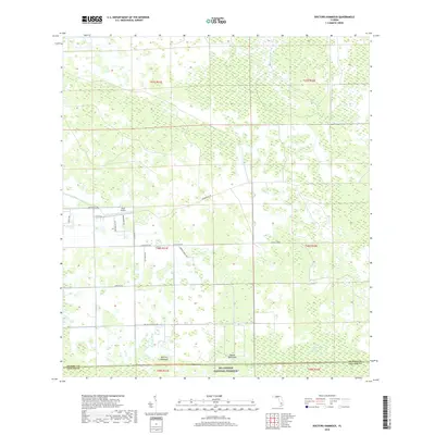
2018 Map of Doctors Hammock
USGS Topo · Published 2018About this map
Big Cypress National Preserve occupies the southern portion of this landscape, marking a transition into the protected wetlands of the Florida interior. The terrain is characterized by a mix of cypress strands and hammocks, including Tony Strand in the northeast and Kissimmee Billy Strand to the southeast. These wet prairies and forested islands, such as Doctors Hammock and Dozier Hammock, define the natural drainage patterns of the region.
Find a feature on this map
24 named features on this map. Tap any name to fly to it.
Don’t see what you’re looking for? This feature index may not catch every label — zoom into the map to look around manually.
Map Details
Editions of this 2018 Doctors Hammock Map
This is the sole edition of this map. No revisions or reprints were ever made.
Other maps of this area

1956 · West Palm Beach
USGS Topo · 1:250,000

1957 · West Palm Beach
USGS Topo · 1:250,000

1958 · West Palm Beach
USGS Topo · 1:250,000

1958 · Sunniland
USGS Topo · 1:24,000

1958 · Immokalee NE
USGS Topo · 1:24,000

1959 · Miles City
USGS Topo · 1:24,000

1974 · Immokalee 4 NW
USGS Topo · 1:24,000

1974 · Immokalee 1 SW
USGS Topo · 1:24,000

1974 · Immokalee 1 SE
USGS Topo · 1:24,000

1974 · Immokalee 1 NE
USGS Topo · 1:24,000