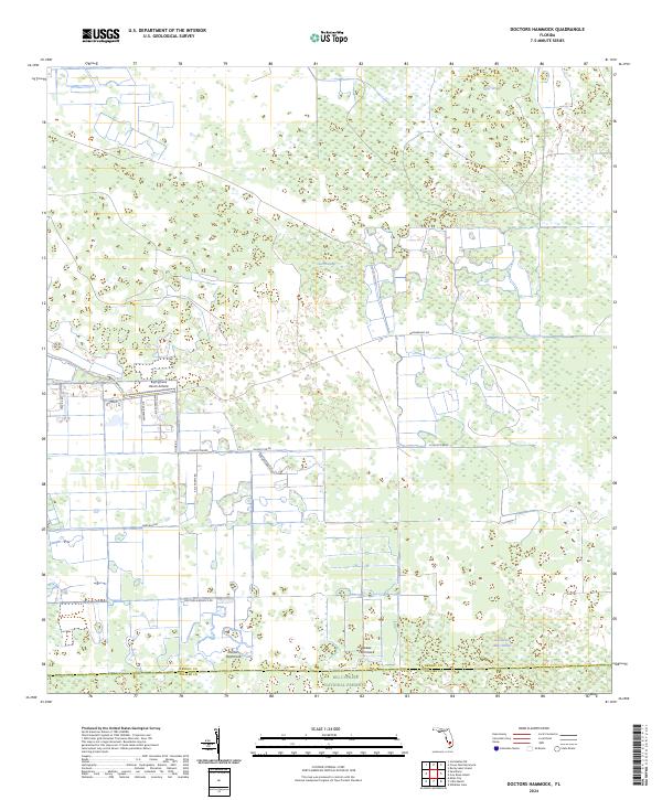
2024 Map of Doctors Hammock
USGS Topo · Published 2024About this map
Doctors Hammock serves as a focal point in this 2024 landscape where the wetlands of the Everglades meet managed agricultural and ranching lands. This transition is marked by several distinctive hardwood hammocks, including Dozier Hammock, which rise above the surrounding swampy terrain of the Big Cypress National Preserve along the southern boundary. The northern reaches are characterized by cypress strands and wetlands like Gum Swamp and Tony Strand, while the central portion reveals a network of rural roads such as Schultz Grade and Burdine Ranch Rd that service local ranching operations. The presence of the Big Cypress Ranch Airfield highlights the logistical demands of managing large tracts of land in this remote part of South Florida, where the Hendry and Collier County line defines the southern edge of the survey.
Find a feature on this map
26 named features on this map. Tap any name to fly to it.
Don’t see what you’re looking for? This feature index may not catch every label — zoom into the map to look around manually.
Map Details
Editions of this 2024 Doctors Hammock Map
This is the sole edition of this map. No revisions or reprints were ever made.
Other maps of this area

1956 · West Palm Beach
USGS Topo · 1:250,000

1957 · West Palm Beach
USGS Topo · 1:250,000

1958 · West Palm Beach
USGS Topo · 1:250,000

1958 · Sunniland
USGS Topo · 1:24,000

1958 · Immokalee NE
USGS Topo · 1:24,000

1959 · Miles City
USGS Topo · 1:24,000

1974 · Immokalee 4 NW
USGS Topo · 1:24,000

1974 · Immokalee 1 SW
USGS Topo · 1:24,000

1974 · Immokalee 1 SE
USGS Topo · 1:24,000

1974 · Immokalee 1 NE
USGS Topo · 1:24,000