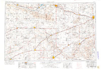
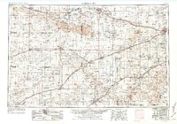
1955 Map of Dodge City
USGS Topo · Published 1976About this map
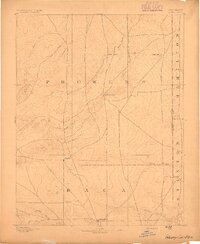
Arkansas River and Cimarron River drainage basins dominate this mid-century western Kansas landscape, reflecting an economy built on water management and energy extraction. The map documents the extensive irrigation infrastructure of the era, such as the Amazon Ditch and the reservoir at Lake McKinney, essential for agriculture in the semi-arid high plains. Throughout the region, from the Sand hills of the north to the state border, the landscape is densely populated with Numerous gas wells, signaling the peak expansion of the Hugoton Gas Area. Settlement patterns follow the established rail corridors of the Atchison Topeka and Santa Fe and the Chicago Rock Island and Pacific railroads. Notable local sites include Meade St Park, featuring Lake Larrabee, and educational landmarks like the Riverview School. Smaller settlements such as Satanta, Montezuma, and Kismet serve as nodes in a network of roads including US Highway 50 and US Highway 54.
Find a feature on this map
84 named features on this map. Tap any name to fly to it.
Don’t see what you’re looking for? This feature index may not catch every label — zoom into the map to look around manually.
Map Details
Editions of this 1955 Dodge City Map
3 editions found

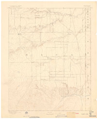
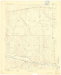
Other maps of this area

1890 · Granada
USGS Topo · 1:125,000

1891 · Albany
USGS Topo · 1:125,000

1891 · Larned
USGS Topo · 1:125,000

1892 · Ness
USGS Topo · 1:125,000

1892 · Meade
USGS Topo · 1:125,000

1892 · Dodge
USGS Topo · 1:125,000
1892 · Vilas
USGS Topo · 1:125,000
1892 · Granada
USGS Topo · 1:125,000

1892 · Spearville
USGS Topo · 1:125,000
1893 · Albany
USGS Topo · 1:125,000