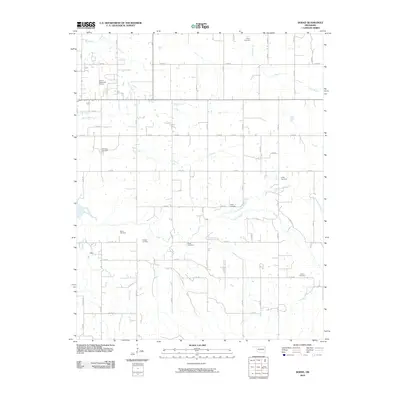
2010 Map of Dodge
USGS Topo · Published 2010About this map
Small rural cemeteries and family burial grounds are scattered throughout this portion of Delaware County, marking the deep ancestral ties of the northeast Oklahoma landscape. From Pollan Cemetery in the north to Polson Cemetery in the south, these sites reflect a history of settlement along the numerous small tributaries that feed the regional watershed. Watercourses like Wolf Creek, Honey Creek, and Elm Creek create a rhythmic drainage pattern across the terrain, which is largely organized by an orderly grid of section roads. Modern developments are represented by the Grove Municipal Airport in the northwest, serving as a hub for the nearby community of Grove. Genealogists can trace local family names through other sites including Butler, Scraper, and Snell Cemetery, each situated near the winding banks of Snail Creek or the Cave Springs Branch.
Find a feature on this map
44 named features on this map. Tap any name to fly to it.
Don’t see what you’re looking for? This feature index may not catch every label — zoom into the map to look around manually.
Map Details
Editions of this 2010 Dodge Map
This is the sole edition of this map. No revisions or reprints were ever made.
Other maps of this area

1899 · Siloam Springs
USGS Topo · 1:125,000

1903 · Siloam Springs
USGS Topo · 1:125,000

1904 · Siloam Springs
USGS Topo · 1:125,000

1907 · Wyandotte
USGS Topo · 1:125,000

1909 · Wyandotte
USGS Topo · 1:125,000

1954 · Tulsa
USGS Topo · 1:250,000

1958 · Tulsa
USGS Topo · 1:250,000

1963 · Tulsa
USGS Topo · 1:250,000
1964 · Cayuga
USGS Topo · 1:24,000

1964 · Dodge
USGS Topo · 1:24,000