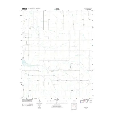
2012 Map of Dodge
USGS Topo · Published 2012About this map
Honey Creek and its various tributaries, including Cave Springs Branch and Elm Creek, define the landscape of eastern Delaware County in this 2012 survey. The settlement of Dodge serves as a central point in a region primarily organized by a grid of rural roads and section lines. The western edge of the quadrangle is marked by the shoreline of Grand Lake O' the Cherokees, which contrasts with the inland agricultural and aviation focus around Grove Municipal Airport.
Find a feature on this map
65 named features on this map. Tap any name to fly to it.
Don’t see what you’re looking for? This feature index may not catch every label — zoom into the map to look around manually.
Map Details
Editions of this 2012 Dodge Map
This is the sole edition of this map. No revisions or reprints were ever made.
Other maps of this area

1899 · Siloam Springs
USGS Topo · 1:125,000

1903 · Siloam Springs
USGS Topo · 1:125,000

1904 · Siloam Springs
USGS Topo · 1:125,000

1907 · Wyandotte
USGS Topo · 1:125,000

1909 · Wyandotte
USGS Topo · 1:125,000

1954 · Tulsa
USGS Topo · 1:250,000

1958 · Tulsa
USGS Topo · 1:250,000

1963 · Tulsa
USGS Topo · 1:250,000
1964 · Cayuga
USGS Topo · 1:24,000

1964 · Dodge
USGS Topo · 1:24,000