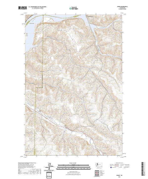
2023 Map of Dodge
USGS Topo · Published 2023About this map
The Snake River defines the northern edge of this Garfield County landscape, where the waters pass by New York Bar and New York Island before meeting the crossing at Central Ferry. This modern topographic survey highlights a terrain carved by steep draws and ridges, most notably Kuhl Ridge and the prominent Dodge Hill. The settlement pattern follows the lower elevations of the Pataha Valley, where the small communities of Dodge and Chard sit along the drainage of Pataha Creek. In the south, the map captures the transition toward Houser near the Columbia and Garfield County line. The complex network of coulees, including New York Gulch, Willow Gulch, and Phalen Gulch, illustrates the dramatic vertical relief of this part of eastern Washington.
Find a feature on this map
33 named features on this map. Tap any name to fly to it.
Don’t see what you’re looking for? This feature index may not catch every label — zoom into the map to look around manually.
Map Details
Editions of this 2023 Dodge Map
This is the sole edition of this map. No revisions or reprints were ever made.
Other maps of this area

1937 · Pomeroy
USGS Topo · 1:96,000

1942 · Pomeroy
USGS Topo · 1:125,000

1950 · Penawawa
USGS Topo · 1:62,500

1950 · Hay
USGS Topo · 1:62,500

1952 · Hay
USGS Topo · 1:62,500

1955 · Pullman
USGS Topo · 1:250,000

1958 · Pullman
USGS Topo · 1:250,000

1967 · Turner
USGS Topo · 1:24,000
1967 · Zumwalt
USGS Topo · 1:24,000
1967 · Tucannon
USGS Topo · 1:24,000