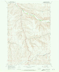
1967 Map of Tucannon
USGS Topo · Published 1971About this map
The Tucannon River carves a deep valley through this Columbia County landscape, serving as the primary corridor for the small settlement of Tucannon. At the time of this 1967 field check, the area maintained a remote, rural character centered on water access and agriculture. Further south, the community around Whetstone is anchored by Whetstone Hollow and a nearby Landing Strip, while the Harmony Community Hall provides evidence of a centralized social point for the surrounding Smith Hollow residents.
Find a feature on this map
14 named features on this map. Tap any name to fly to it.
Don’t see what you’re looking for? This feature index may not catch every label — zoom into the map to look around manually.
Map Details
Editions of this 1967 Tucannon Map
This is the sole edition of this map. No revisions or reprints were ever made.
Other maps of this area

1919 · Walla Walla
USGS Topo · 1:125,000

1921 · Walla Walla
USGS Topo · 1:125,000

1937 · Pomeroy
USGS Topo · 1:96,000

1942 · Pomeroy
USGS Topo · 1:125,000

1948 · Starbuck
USGS Topo · 1:62,500

1950 · Starbuck
USGS Topo · 1:62,500

1950 · Hay
USGS Topo · 1:62,500

1952 · Hay
USGS Topo · 1:62,500

1953 · Walla Walla
USGS Topo · 1:250,000

1955 · Pullman
USGS Topo · 1:250,000