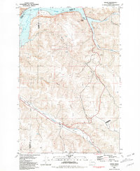
1981 Map of Dodge
USGS Topo · Published 1981About this map
The confluence of river commerce and rail transport is evident along the Snake River at the Port of Garfield. This area, where the river meets Lake Bryan, serves as a critical junction for the region's agricultural output, evidenced by the numerous Storage Bins and the Grain Elevator at Houser. The Union Pacific railroad tracks follow the winding path of the Pataha Valley, tracing the course of Pataha Creek through a landscape defined by dramatic elevation changes between Dodge Hill and Kuhl Ridge.
Find a feature on this map
31 named features on this map. Tap any name to fly to it.
Don’t see what you’re looking for? This feature index may not catch every label — zoom into the map to look around manually.
Map Details
Editions of this 1981 Dodge Map
This is the sole edition of this map. No revisions or reprints were ever made.
Other maps of this area

1937 · Pomeroy
USGS Topo · 1:96,000

1942 · Pomeroy
USGS Topo · 1:125,000

1950 · Penawawa
USGS Topo · 1:62,500

1950 · Hay
USGS Topo · 1:62,500

1952 · Hay
USGS Topo · 1:62,500

1955 · Pullman
USGS Topo · 1:250,000

1958 · Pullman
USGS Topo · 1:250,000

1967 · Turner
USGS Topo · 1:24,000
1967 · Zumwalt
USGS Topo · 1:24,000
1967 · Tucannon
USGS Topo · 1:24,000