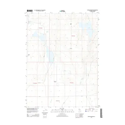
2015 Map of Dodge Reservoir
USGS Topo · Published 2015About this map
Dodge Reservoir and the adjacent Red Rock Cr anchor the northeastern corner of this arid landscape in Lassen County. The terrain is defined by a series of basins and flats, notably the expansive Madeline Plains and Cold Spring Valley, where seasonal water management is evident through a network of catchments including Rager Reservoir, Dunn Reservoir, and Union Reservoir. Elevation changes are marked by isolated features like Sugarloaf and Dorsey Butte, while Rabbit Basin sits near the northern boundary. The local infrastructure consists primarily of rural routes such as Tuledad Rd, Stage Rd, and Frederick Rd, reflecting a landscape dedicated to ranching or resource management within the high desert environment of the early twenty-first century.
Find a feature on this map
24 named features on this map. Tap any name to fly to it.
Don’t see what you’re looking for? This feature index may not catch every label — zoom into the map to look around manually.
Map Details
Editions of this 2015 Dodge Reservoir Map
This is the sole edition of this map. No revisions or reprints were ever made.
Other maps of this area

1886 · Alturas
USGS Topo · 1:250,000

1886 · Honey Lake
USGS Topo · 1:250,000

1891 · Honey Lake
USGS Topo · 1:250,000

1892 · Alturas
USGS Topo · 1:250,000

1893 · Honey Lake
USGS Topo · 1:250,000

1954 · Observation Peak
USGS Topo · 1:62,500

1954 · Ravendale
USGS Topo · 1:62,500

1954 · Alturas
USGS Topo · 1:250,000

1955 · Westwood
USGS Topo · 1:250,000

1958 · Alturas
USGS Topo · 1:250,000