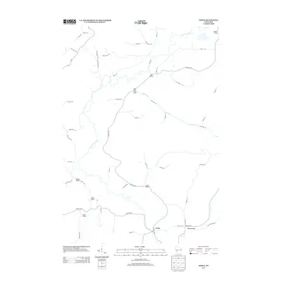
2013 Map of Dodge
USGS Topo · Published 2013About this map
The Trempealeau River meanders through this portion of western Wisconsin, defining a landscape characterized by deep coulees and distinct valleys. This 2013 survey illustrates the agricultural and rural residential patterns of the Driftless Area, where naming conventions often follow the topography, as seen in Meyers Valley and Bill Valley. The small settlement of Dodge serves as a local hub near the junction of County Hwy-J, while the community of Pine Creek sits to the east. Several significant drainage systems, including Trout Run Cr and Schmitt Cr, carve through the land, each supporting its own named valley system like Trout Run Creek Valley. The intricate network of local roads, such as Joos Valley Rd and Boland Valley Rd, trace the natural contours of the bluffs and bottoms, revealing the enduring layout of family-named land tracts and rural access routes.
Find a feature on this map
54 named features on this map. Tap any name to fly to it.
Don’t see what you’re looking for? This feature index may not catch every label — zoom into the map to look around manually.
Map Details
Editions of this 2013 Dodge Map
This is the sole edition of this map. No revisions or reprints were ever made.
Other maps of this area

1926 · Whitehall
USGS Topo · 1:62,500

1929 · Whitehall
USGS Topo · 1:62,500

1929 · Fountain City
USGS Topo · 1:62,500

1929 · Galesville
USGS Topo · 1:62,500

1932 · Gilmanton
USGS Topo · 1:62,500

1934 · Winona
USGS Topo · 1:62,500

1937 · Winona
USGS Topo · 1:62,500

1953 · Eau Claire
USGS Topo · 1:250,000

1958 · Eau Claire
USGS Topo · 1:250,000

1964 · Eau Claire
USGS Topo · 1:250,000