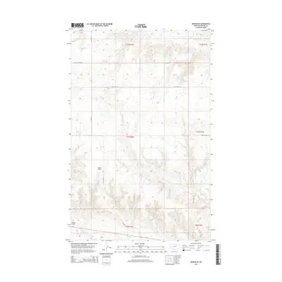
2014 Map of Dodson NE
USGS Topo · Published 2014About this map
Wagner Coulee and the winding drainages of North-Central Montana define this landscape south of the Milk River valley during the early 21st century. The map shows a region shaped by large-scale township and range divisions, where infrastructure is primarily focused on a sparse network of county roads like Dodson Cutacross Rd and N Wagner Rd. These routes connect remote agricultural tracts across several township lines, including t31n r28e and t32n r29e. Hydrological features such as Exeter Cr and Assiniboine Cr provide the primary natural landmarks in an area otherwise characterized by high plains topography. Along the southern margin, the corridor for Us-2 appears, indicating the primary transportation artery for Phillips County. The lack of concentrated settlements highlights the enduring rural and pastoral nature of this part of the state.
Find a feature on this map
14 named features on this map. Tap any name to fly to it.
Don’t see what you’re looking for? This feature index may not catch every label — zoom into the map to look around manually.
Map Details
Editions of this 2014 Dodson NE Map
This is the sole edition of this map. No revisions or reprints were ever made.
Other maps of this area

1920 · Avery
USGS Topo · 1:125,000

1920 · Cowan
USGS Topo · 1:125,000

1953 · Havre
USGS Topo · 1:250,000

1954 · Glasgow
USGS Topo · 1:250,000

1957 · Glasgow
USGS Topo · 1:250,000

1957 · Havre
USGS Topo · 1:250,000

1958 · Glasgow
USGS Topo · 1:250,000

1958 · Havre
USGS Topo · 1:250,000

1964 · Dodson NE
USGS Topo · 1:24,000

1964 · Dodson
USGS Topo · 1:24,000