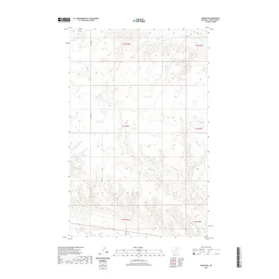
2020 Map of Dodson NE
USGS Topo · Published 2020About this map
Dodson N Canal cuts across the southern reach of this Phillips County landscape, representing the vital water infrastructure of northern Montana. The terrain is defined by the dendritic drainage patterns of Assiniboine Cr and Exeter Cr, which carve through the high plains. The map illustrates the structured division of the Public Land Survey System, spanning portions of T32N, T31N, and T30N across ranges R28E and R29E. Human passage through this open country is primarily marked by N Wagner Rd, which runs north-south through the western sections. This survey provides a precise look at the elevation and hydrology of the Milk River valley region, showing how limited water sources and section-line roads dictate the layout of this ranching and agricultural territory.
Find a feature on this map
10 named features on this map. Tap any name to fly to it.
Don’t see what you’re looking for? This feature index may not catch every label — zoom into the map to look around manually.
Map Details
Editions of this 2020 Dodson NE Map
This is the sole edition of this map. No revisions or reprints were ever made.
Other maps of this area

1920 · Avery
USGS Topo · 1:125,000

1920 · Cowan
USGS Topo · 1:125,000

1953 · Havre
USGS Topo · 1:250,000

1954 · Glasgow
USGS Topo · 1:250,000

1957 · Glasgow
USGS Topo · 1:250,000

1957 · Havre
USGS Topo · 1:250,000

1958 · Glasgow
USGS Topo · 1:250,000

1958 · Havre
USGS Topo · 1:250,000

1964 · Dodson NE
USGS Topo · 1:24,000

1964 · Dodson
USGS Topo · 1:24,000