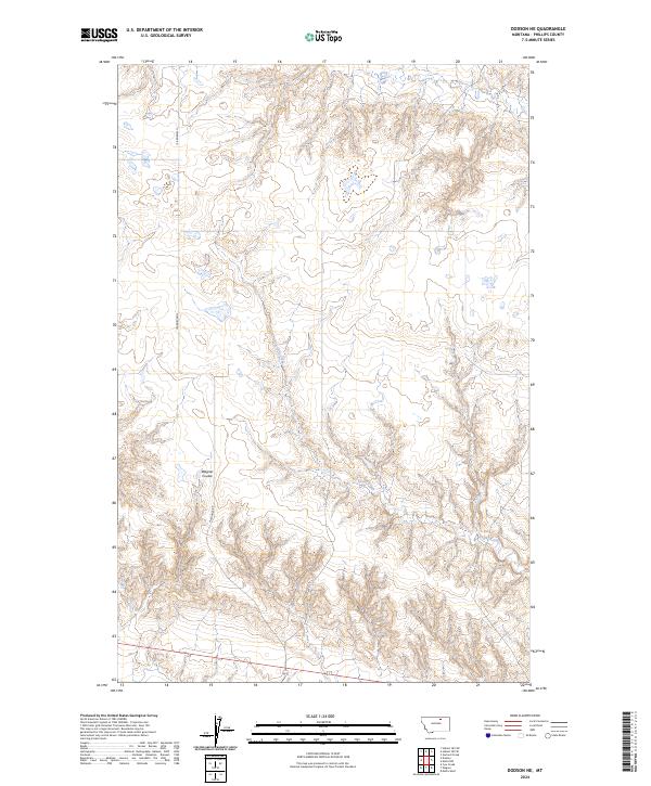
2024 Map of Dodson NE
USGS Topo · Published 2024About this map
Exeter Creek meanders through the heart of this Phillips County landscape, defining the local drainage patterns across the northern plains of Montana. The terrain is marked by the distinct formation of Wagner Coulee, a significant geographical feature that likely influenced early navigation and land use in this section of the state. The presence of N Wagner Rd provides a key north-south corridor through the survey area, tracing a path that connects disparate sections of the township grid. While largely characterized by open space and natural watercourses, the map meticulously documents the Public Land Survey System boundaries, including t31n r28e and t32n r29e, which provide the essential framework for understanding property and historical land distribution in this rural territory.
Find a feature on this map
9 named features on this map. Tap any name to fly to it.
Don’t see what you’re looking for? This feature index may not catch every label — zoom into the map to look around manually.
Map Details
Editions of this 2024 Dodson NE Map
This is the sole edition of this map. No revisions or reprints were ever made.
Other maps of this area

1920 · Avery
USGS Topo · 1:125,000

1920 · Cowan
USGS Topo · 1:125,000

1953 · Havre
USGS Topo · 1:250,000

1954 · Glasgow
USGS Topo · 1:250,000

1957 · Glasgow
USGS Topo · 1:250,000

1957 · Havre
USGS Topo · 1:250,000

1958 · Glasgow
USGS Topo · 1:250,000

1958 · Havre
USGS Topo · 1:250,000

1964 · Dodson NE
USGS Topo · 1:24,000

1964 · Dodson
USGS Topo · 1:24,000