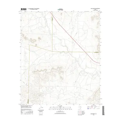
2016 Map of Dog Creek NE
USGS Topo · Published 2016About this map
The N Concho River flows through the high plains of West Texas in this 2016 survey, cutting through a landscape defined by seasonal drainages and wide ranchlands. This section of the Edwards Plateau shows the intersection of Sterling, Coke, and Tom Green counties, where the terrain is marked by the winding paths of Mulberry Cr and Coyote Cr. The map captures a primarily rural and undeveloped area, where transportation is limited to established routes like Walnut Rd and Sisco Rd that navigate the topographic rises between creek beds. Smaller ephemeral watercourses, including Little Walnut Cr and Dry Cr, illustrate the drainage patterns characteristic of the Concho Valley region. The placement of Hall Ln and various county roads indicates the sparse but persistent ranching infrastructure that supports the local cattle and livestock economy.
Find a feature on this map
15 named features on this map. Tap any name to fly to it.
Don’t see what you’re looking for? This feature index may not catch every label — zoom into the map to look around manually.
Map Details
Editions of this 2016 Dog Creek NE Map
This is the sole edition of this map. No revisions or reprints were ever made.
Other maps of this area

1954 · San Angelo
USGS Topo · 1:250,000

1957 · Carlsbad
USGS Topo · 1:62,500

1958 · San Angelo
USGS Topo · 1:250,000

1965 · San Angelo
USGS Topo · 1:250,000

1972 · Sterling City
USGS Topo · 1:24,000

1972 · Dog Creek NE
USGS Topo · 1:24,000

1972 · Dog Creek SW
USGS Topo · 1:24,000

1972 · Broome
USGS Topo · 1:24,000

1972 · Dog Creek NW
USGS Topo · 1:24,000
1972 · Dog Creek
USGS Topo · 1:24,000