
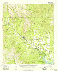
1957 Map of Carlsbad
USGS Topo · Published 1958About this map
The McKnight State Sanatorium and the village of Carlsbad anchor this West Texas landscape along the North Concho River. The Gulf Colorado and Santa Fe Railroad cuts a diagonal path through the terrain, serving the small communities of Carlsbad and Water Valley. This mid-century survey captures the region just as the San Angelo Reservoir was beginning to shape the local hydrology at the confluence of Grape Creek and the river.
Find a feature on this map
38 named features on this map. Tap any name to fly to it.
Don’t see what you’re looking for? This feature index may not catch every label — zoom into the map to look around manually.
Map Details
Editions of this 1957 Carlsbad Map
2 editions found
Other maps of this area

1891 · Hayrick
USGS Topo · 1:125,000

1892 · San Angelo
USGS Topo · 1:125,000

1894 · Hayrick
USGS Topo · 1:125,000

1895 · Sherwood
USGS Topo · 1:125,000

1924 · San Angelo 2-b
USGS Topo · 1:48,000

1924 · Sherwood 1-a
USGS Topo · 1:48,000

1928 · Wall
USGS Topo · 1:62,500

1928 · Tankersly
USGS Topo · 1:62,500

1954 · San Angelo
USGS Topo · 1:250,000

1957 · Twin Buttes
USGS Topo · 1:24,000