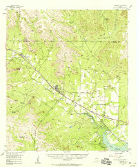
1957 Map of Carlsbad
USGS Topo · Published 1958About this map
McKnight State Sanatorium and the surrounding ranchlands of Tom Green County define this mid-century landscape along the North Concho River. The map captures the specialized local economy of the late 1950s, showing the intersection of healthcare, large-scale livestock operations like the Turner Ranch Headquarters, and the transport infrastructure of the Gulf Colorado and Santa Fe railroad. In the southeast, the newly formed San Angelo Reservoir has altered the drainage of Grape Creek and Bald Creek, reflecting the era's significant water management projects.
Find a feature on this map
42 named features on this map. Tap any name to fly to it.
Don’t see what you’re looking for? This feature index may not catch every label — zoom into the map to look around manually.
Map Details
Editions of this 1957 Carlsbad Map
2 editions found
Other maps of this area

1891 · Hayrick
USGS Topo · 1:125,000

1892 · San Angelo
USGS Topo · 1:125,000

1894 · Hayrick
USGS Topo · 1:125,000

1895 · Sherwood
USGS Topo · 1:125,000

1924 · San Angelo 2-b
USGS Topo · 1:48,000

1924 · Sherwood 1-a
USGS Topo · 1:48,000

1928 · Wall
USGS Topo · 1:62,500

1928 · Tankersly
USGS Topo · 1:62,500

1954 · San Angelo
USGS Topo · 1:250,000

1957 · Carlsbad
USGS Topo · 1:62,500